As an industry, Geospatial services generate around 400 billion in revenue per year making it vital for the world economy and society today. With location becoming all-pervasive in our everyday life, there has been an exponential growth in the amount of spatial data being generated and captured. Geospatial analysis is used to derive new information and make informed decisions. That being said, accuracy and precision requirements for geospatial services have drastically changed over time. Comprehending the scope and restraints of the landscape has now emerged as the key strategy.
Here, conventional methods and equipment fail to address these issues. Into this scenario, enters THE SPATIO, a geospatial engineering service company from Lahore, Pakistan. THE SPATIO, is a one-stop GIS service provider that offers cost-effective consultancy services for technical solutions of geospatial data collection in the fields of engineering planning, design, and management. The company offers advanced remote sensing and engineering surveys that revolve around state-of-the-art practices. They also deliver custom-based solutions and applications.
The Inception Story
The company was incepted in 2012 with an aim to provide geospatial engineering and mapping services in a modern way. We started off as a small setup in Lahore gradually began to incorporate drones for mapping in 2014. Since the concept was relatively new to the landscape, there were certainly a few challenges that had to be dealt with, like initial costs and operational risks, and even the loss of several drones. Despite all that, THE SPATIO managed to evolve their workflow with time into more efficient and swift procedures by adopting the latest technology and innovative methods.
Eventually, they scaled to become authentic and reliable aerial surveyors. The company now deals with versatile survey domains covering geodetic, topographic, and hydrographic surveys and has matured to become proficient in UAVs, LiDAR, satellite photogrammetry, and 3D laser scanning.
“We stand out with all-inclusive services in an extensive variety of geospatial engineering, surveying, and mapping", states Imran Anees, Co-Founder & CEO of THE SPATIO. Besides, the company's dedicated R&D team has enabled the development of in-house capabilities required for modifying the process techniques. These features help them to be versatile and flexible with a swift response and embrace a problem-solving approach toward their clientele and their queries. These factors contributed to THE SPATIO.
Securing a comparatively significant share in the marketplace of high-resolution data collection with relative accuracy and precision.
Unique & Distinct Geospatial Solutions
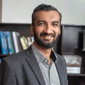
“Our mission is to meet client expectations efficiently with value-added services and our vision is to provide unique and distinct geospatial solutions and engineering services", says Murad Kisana, Co-Founder & Managing Director of THE SPATIO. Kisana continues to explain the broad range of solutions they offer.
They include geodetic/topographic/ hydrographic surveys, structural condition assessment & monitoring studies, surface geological mapping, scanline surveys, and geo-environmental solutions, site/ route selection and optimization studies, climate change assessment and flood hazard mapping, spatial agricultural solutions, GIS/MIS development, building information modeling (BIM), aerial progress monitoring, 3D models & dioramas (scaled physical & portable illustrative models). In addition, he also mentions the two ground-breaking active subsidiaries of the company - Cadomation (a specific commercial entity for providing CAD automation and customization services to their local and international clients) and SpaGrow (that provides precision agricultural solutions to enhance production and health monitoring of crops). 
Murad Kisana, Co-Founder & Managing Director
As referred to above, the company's mission is to meet their client's expectations and it includes outputs that are compatible with local and global mapping parameters. Furthermore, other client requirements include basic precision, accuracy, and authenticity of the surveys or maps with respect to coordinates corresponding to location, orientation, elevations, and levels. THE SPATIO is able to address these demands effectively by means of their in-house expertise and the extensive R&D research segment applied for advanced equipment and techniques.
We stand out with all-inclusive services in an extensive variety of geospatial engineering, surveying, and mapping
Over and above that, THE SPATIO has now entered the next decade of its emergence by registering an instrumental role in the water sector with over 50 projects including dams, irrigation systems, hydropower and flood management projects. Likewise, they have also initiated international extensions of their virtual footprints with in-house developed tools and digital geospatial services. The company also aims to expand their physical presence worldwide and for this reason, they have established an independent business entity for KSA and Middle Eastern Clientele over a collaboration with Petrozone International. Additionally, they also intend to broaden their spectrum of services to engulf floating solar panels, wind power corridors, precision agriculture, CAD automation & customization, GIS/MIS development, and BIM.
Imran Anees, Co-Founder & CEO
Imran Anees and Murad Kisana are the Co-Founders and the CEO and managing director of THE SPATIO respectively. They both come with a collective experience of 20 years from various Consulting Engineering firms as GIS and survey engineers. To be specific, Anees is a civil engineer with a computer science master’s degree and Kisana complements him with his academic qualifications in Remote sensing, GIS and Geomatics.
We use cookies to ensure you get the best experience on our website. Read more...